|

|

|

|

|

|
|
|
|
|
|
|
|


Elevation difference: 193 m
Circuit with shortcut is easy to complete and well suited for families with children.
Long circuit requires higher endurance and physical condition.
Watch the video:
![]()
![]()
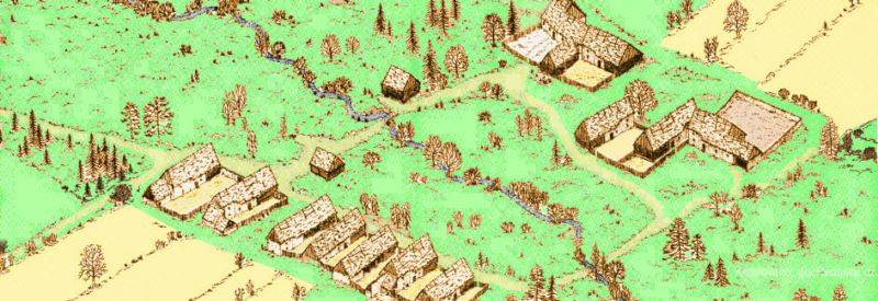
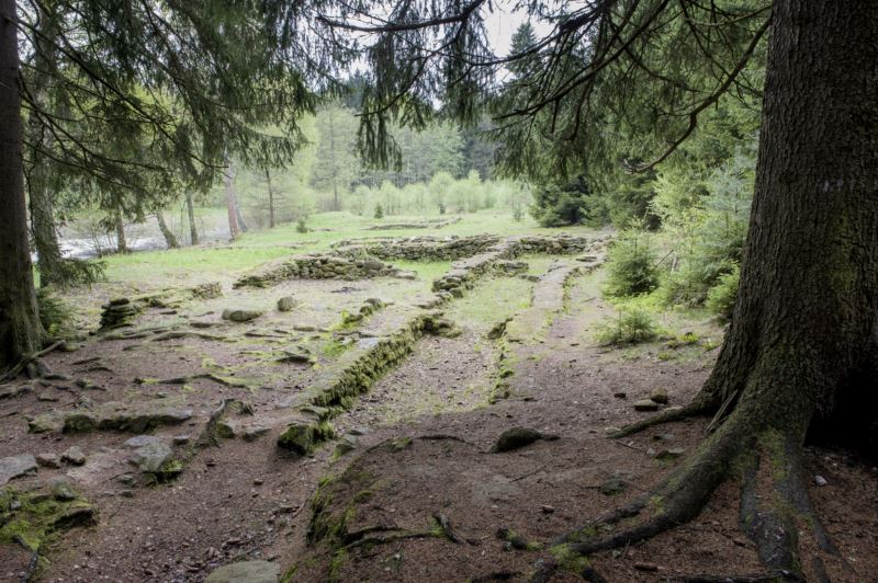
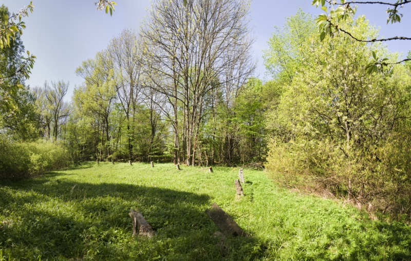
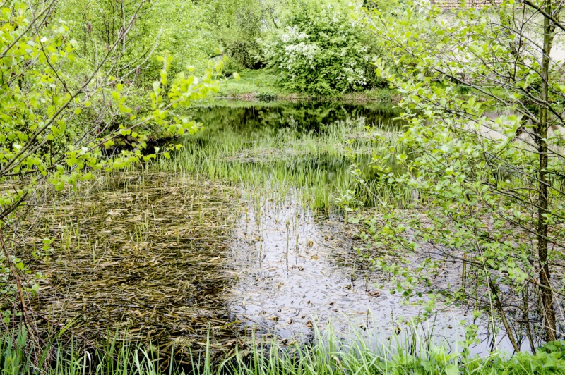
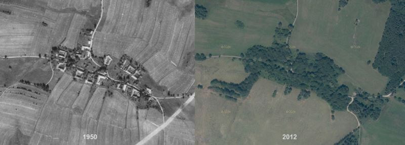
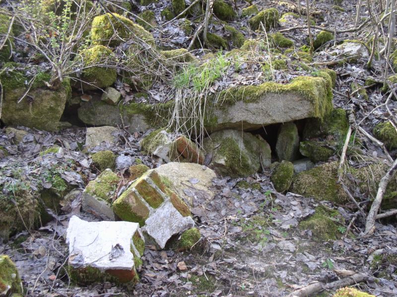
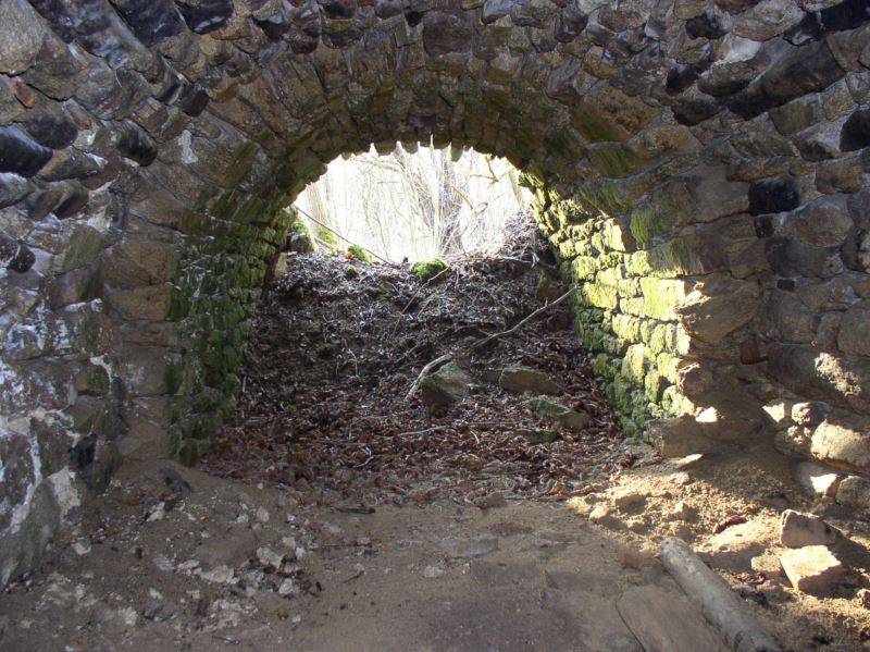
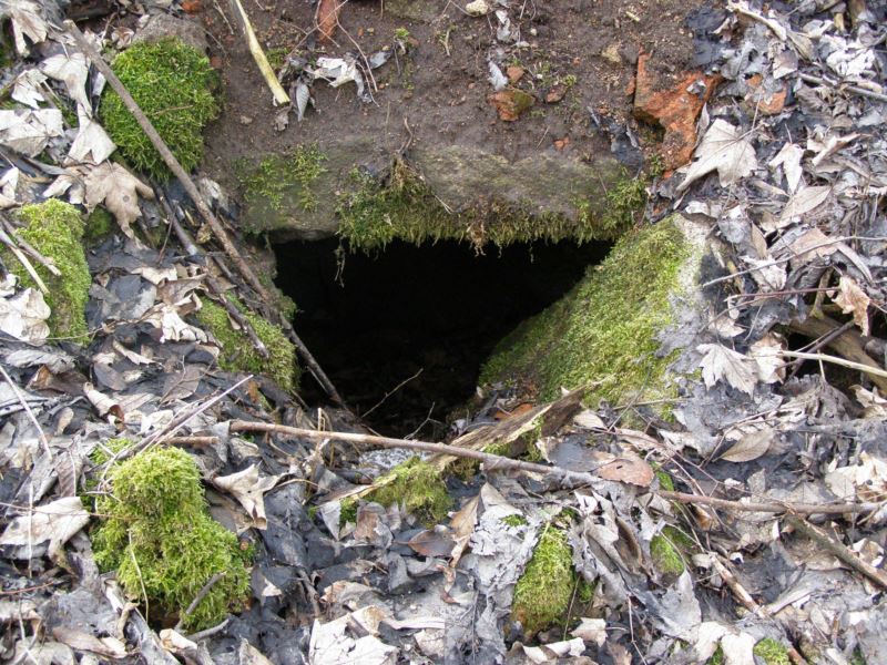
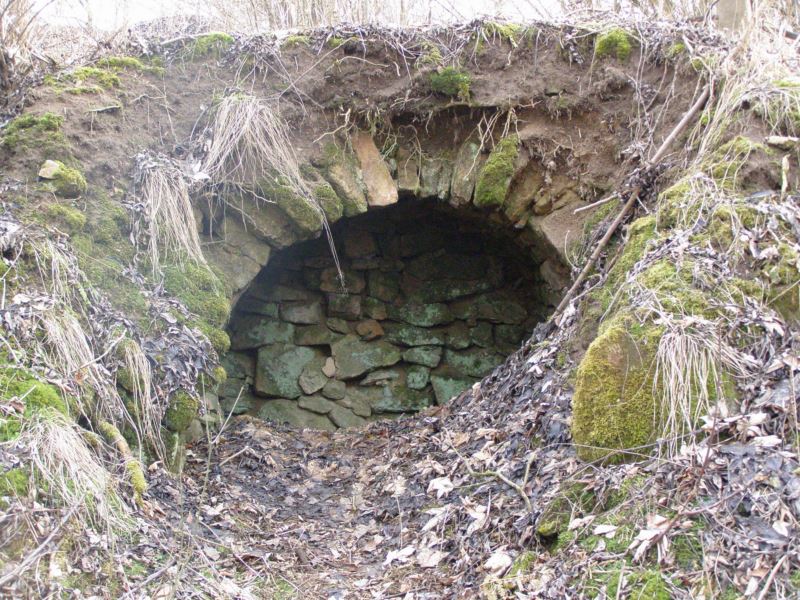
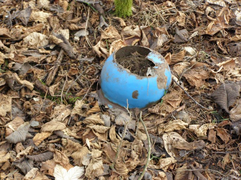
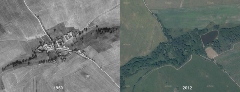
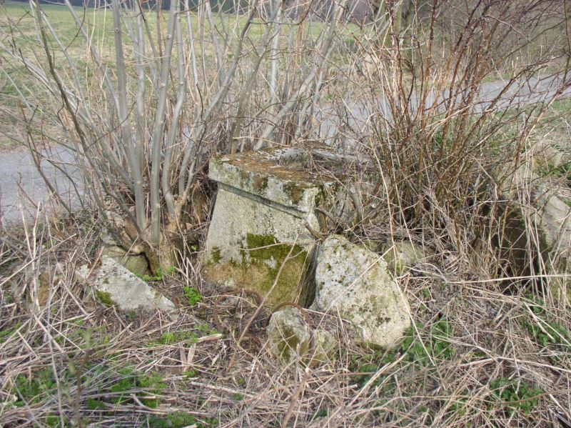
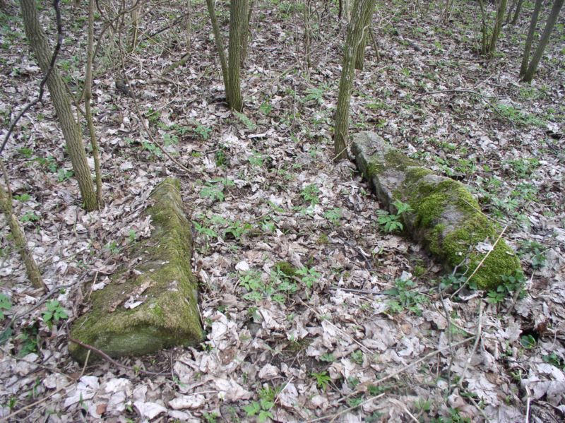
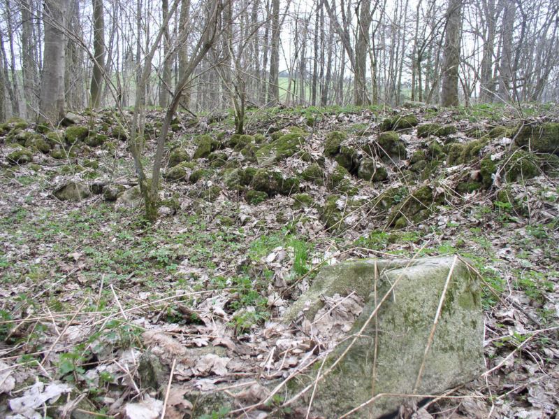
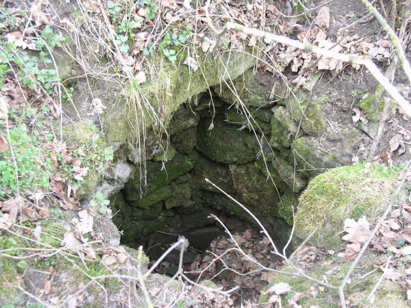
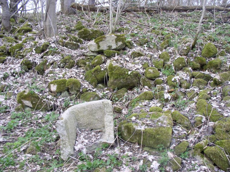
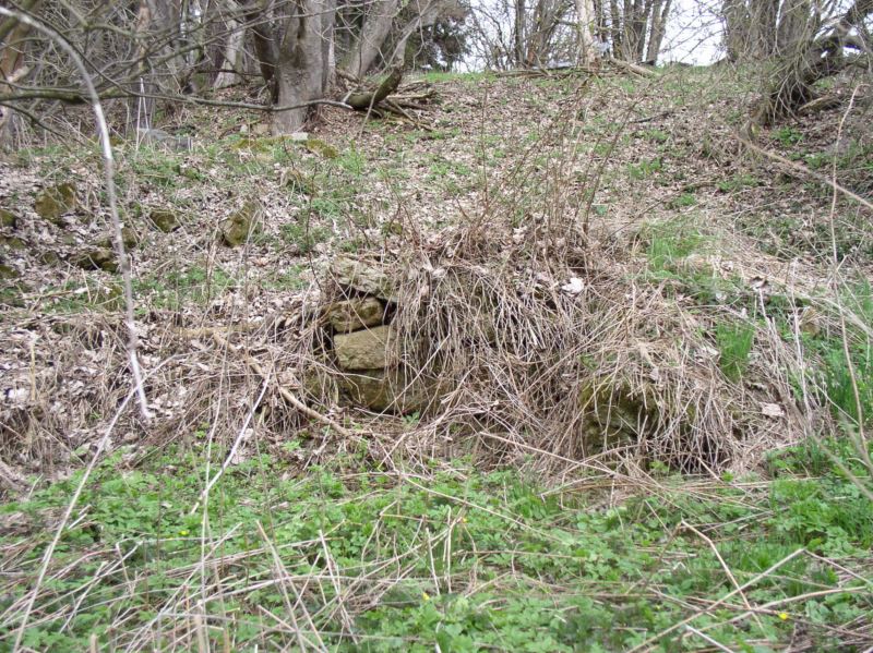
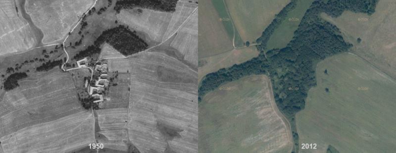
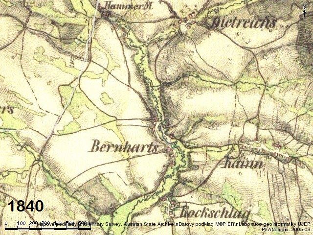
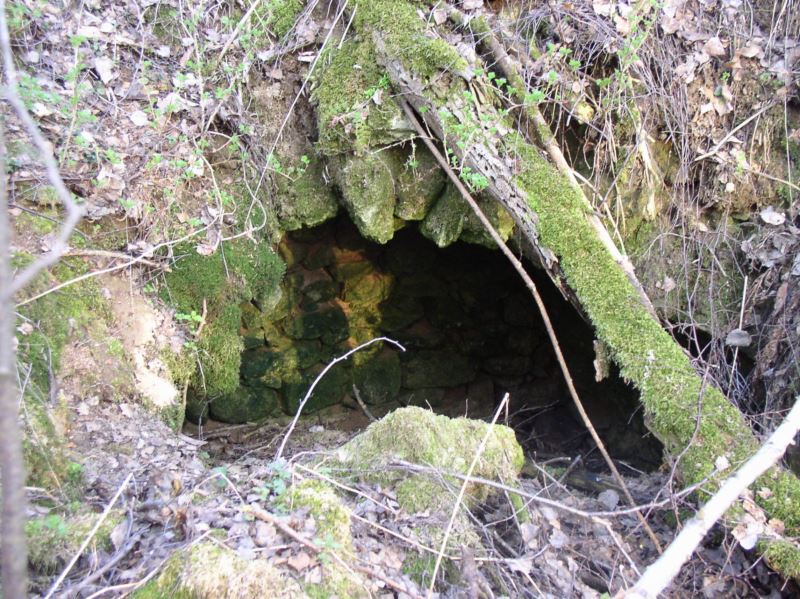
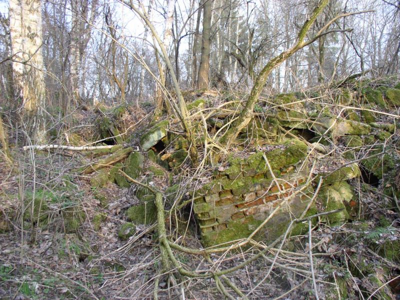
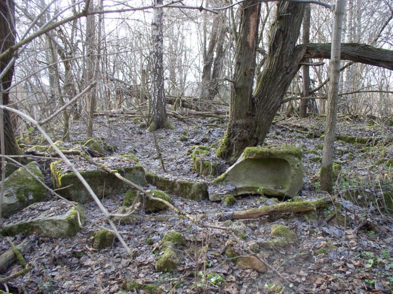
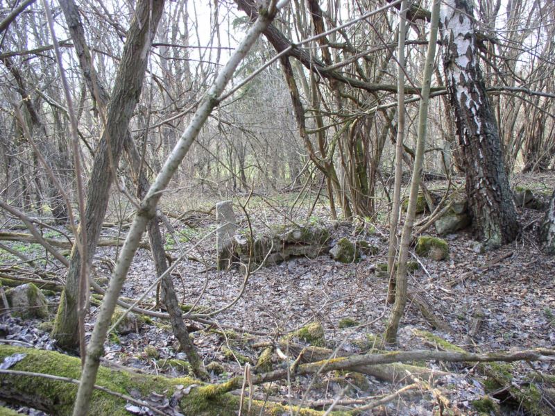
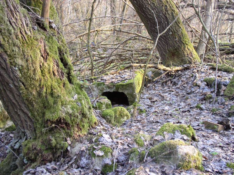
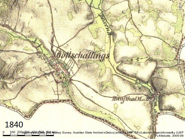
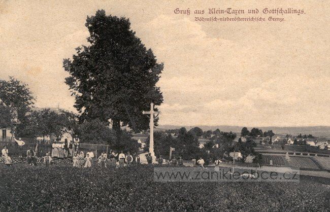
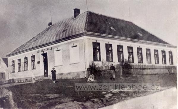
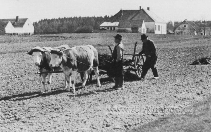
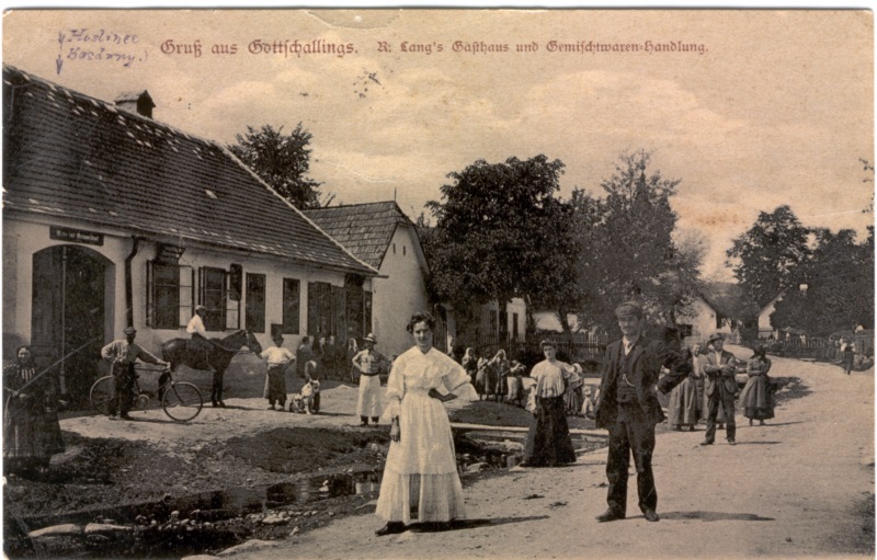
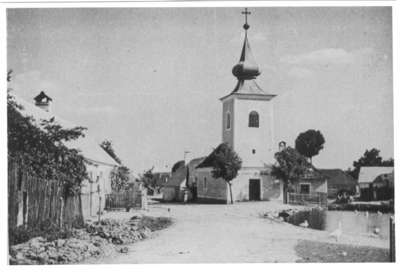
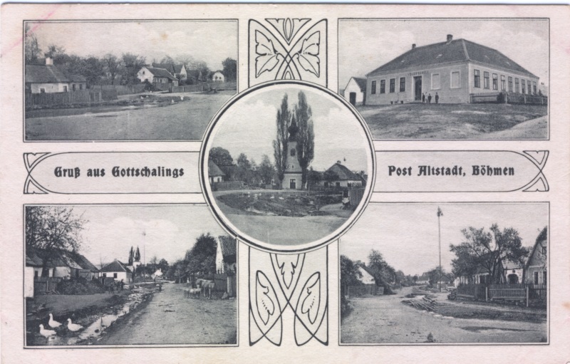
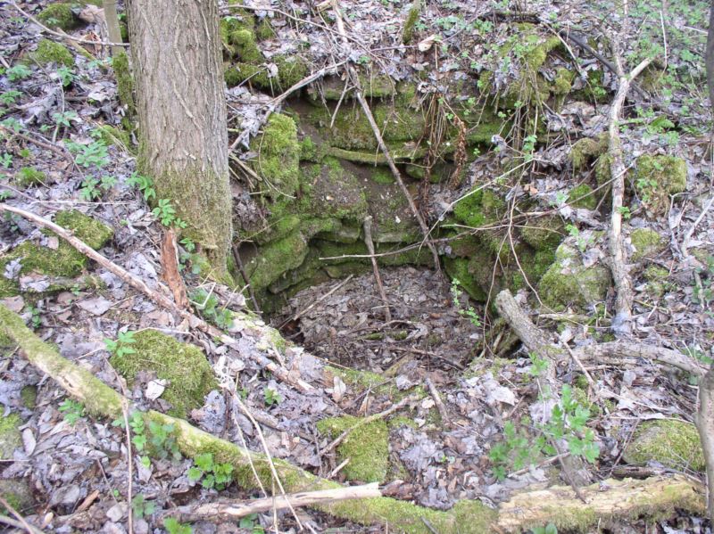
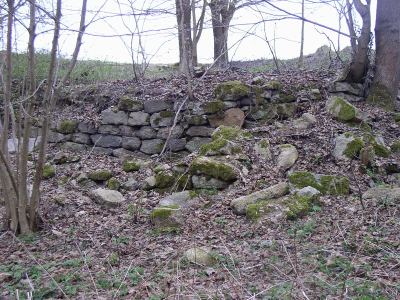
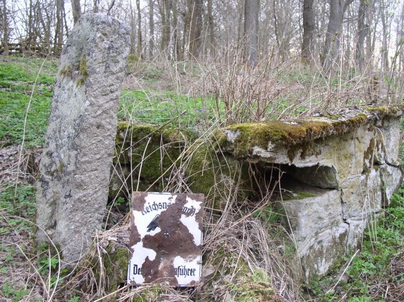
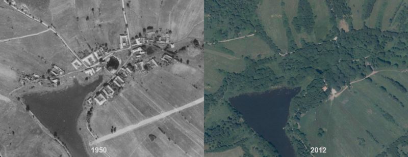
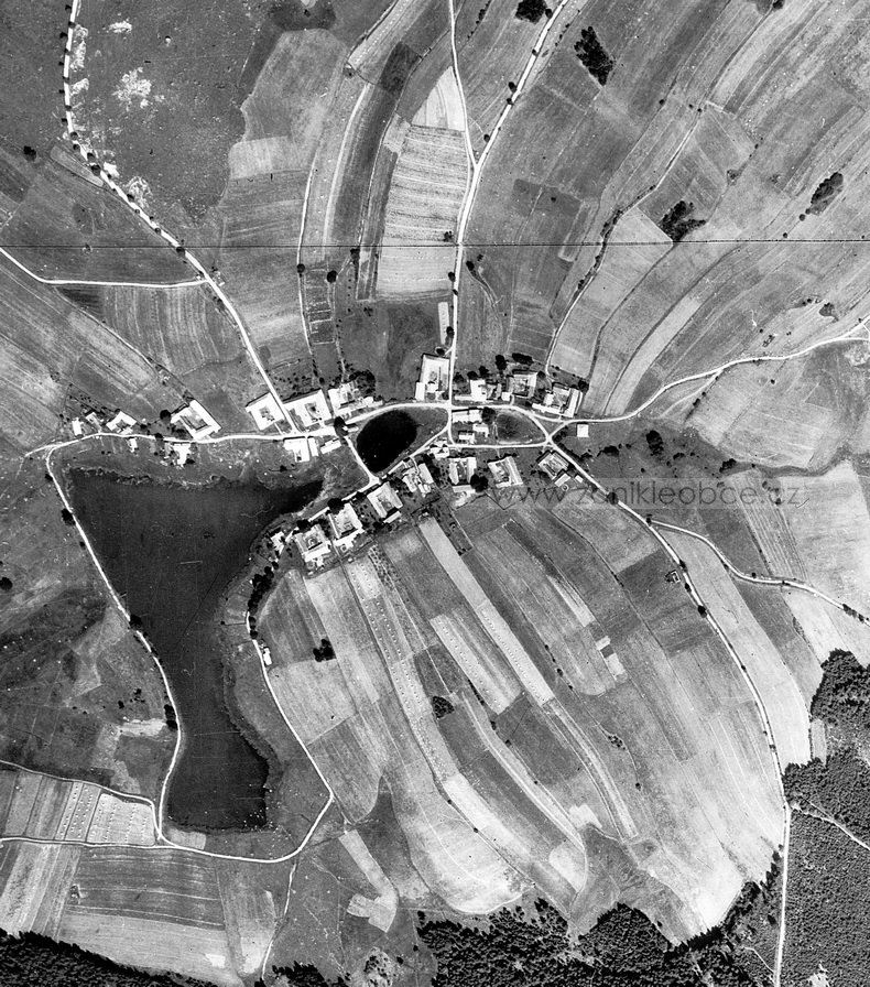
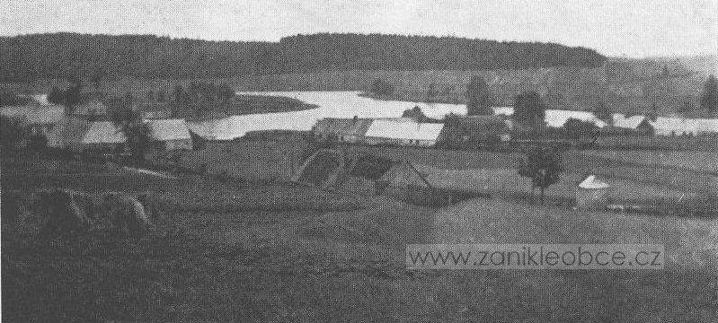
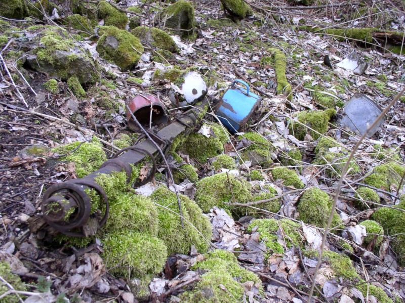
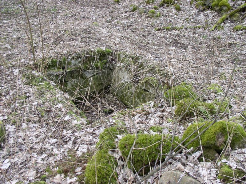
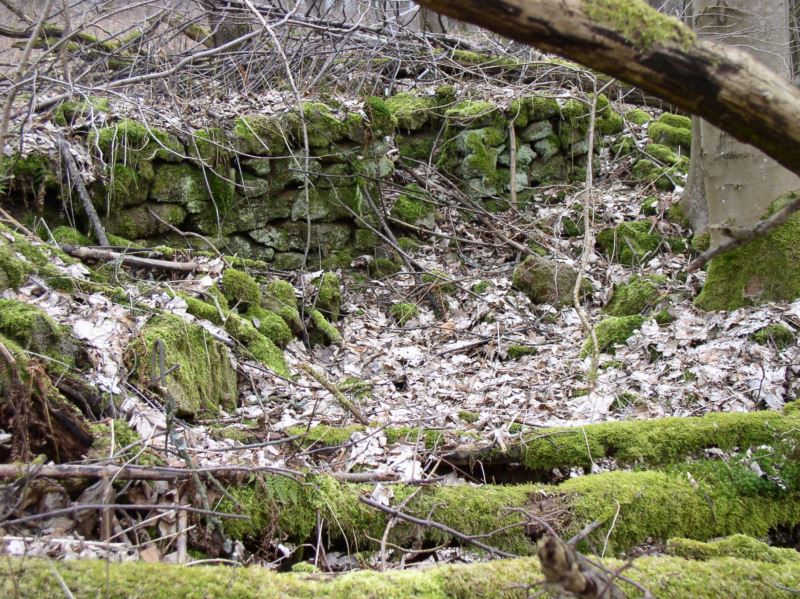
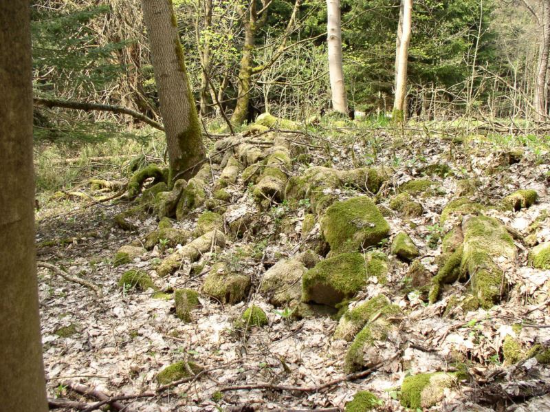
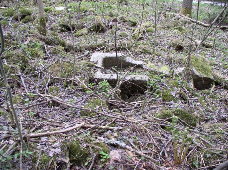
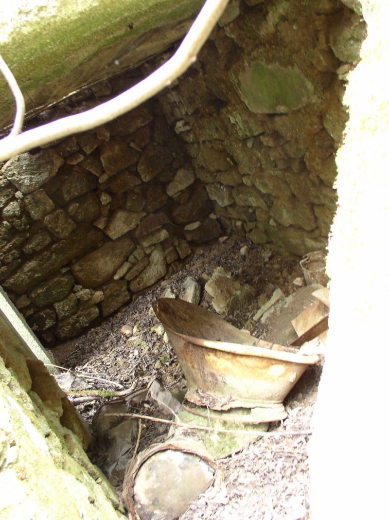
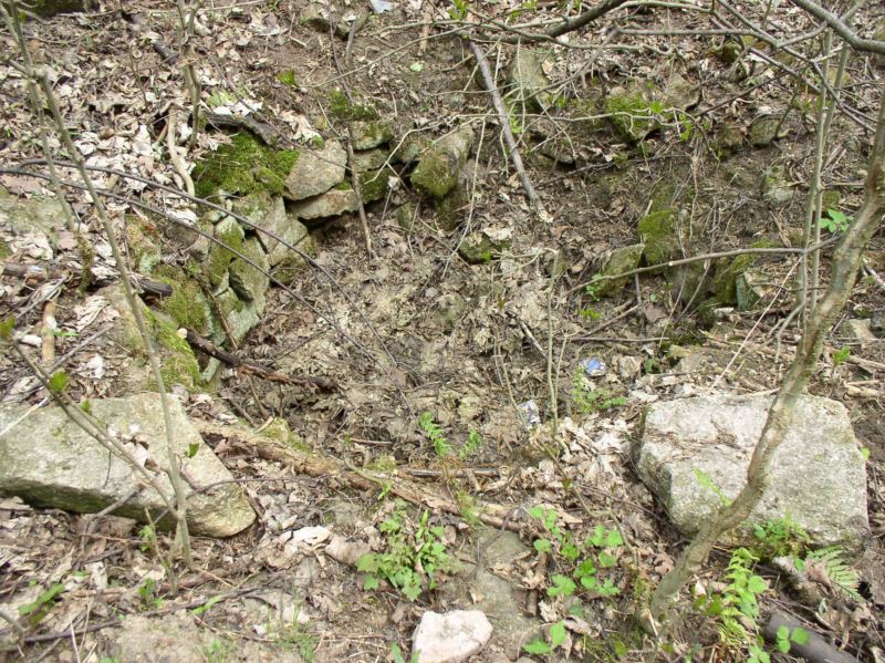
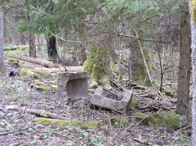
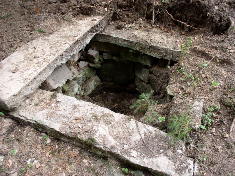
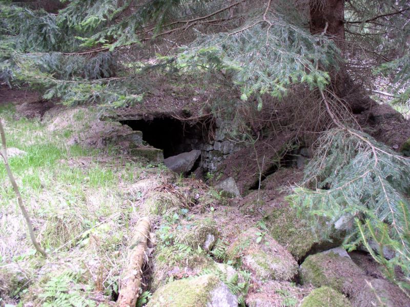
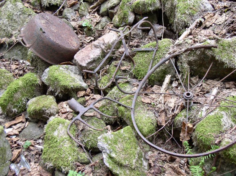
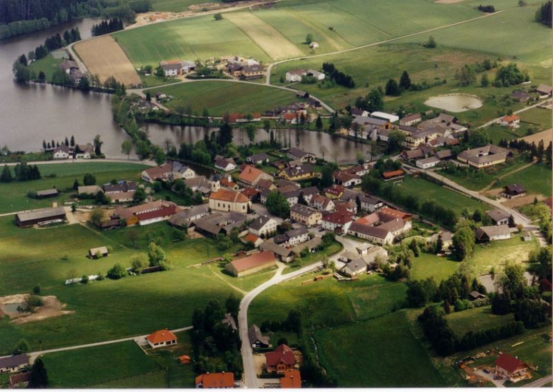
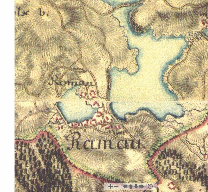
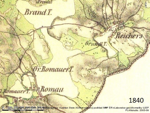
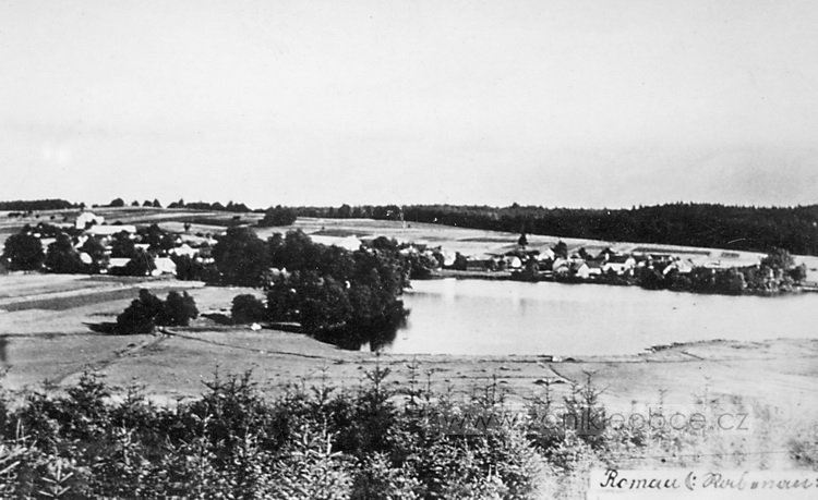
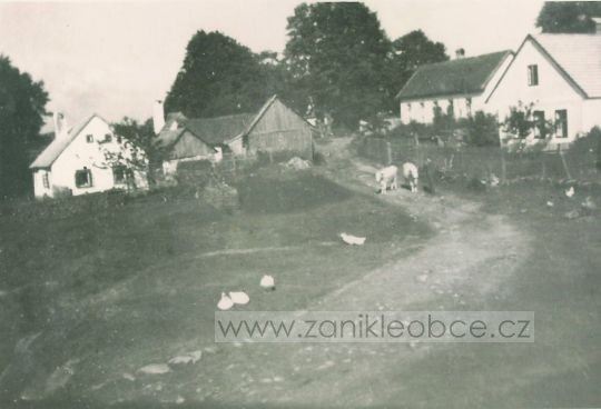
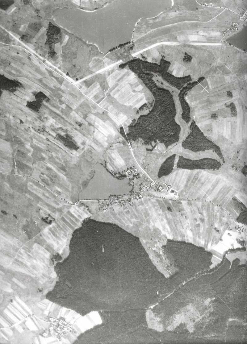
Disappeared villages
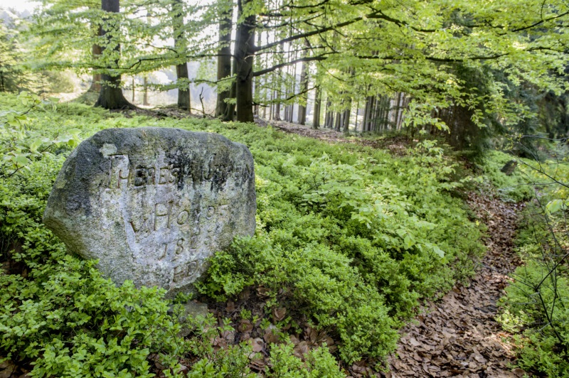
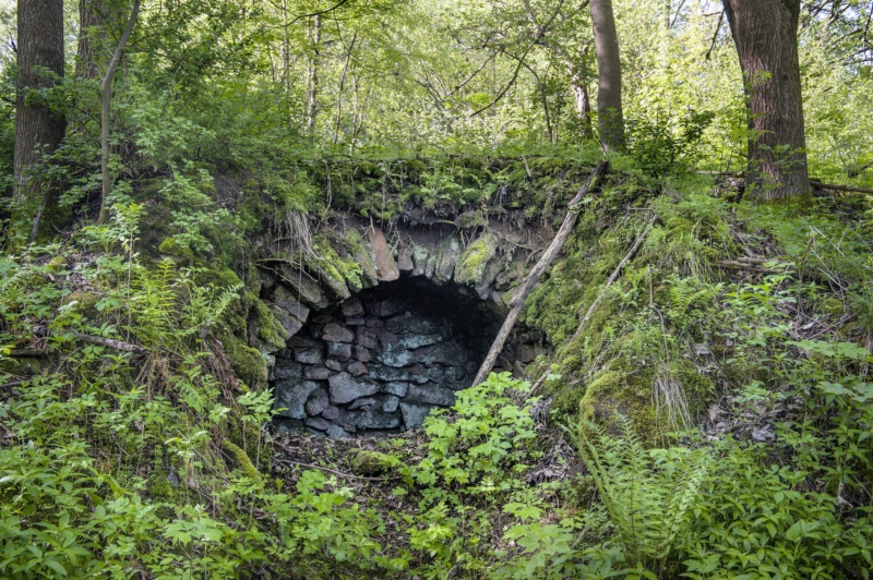
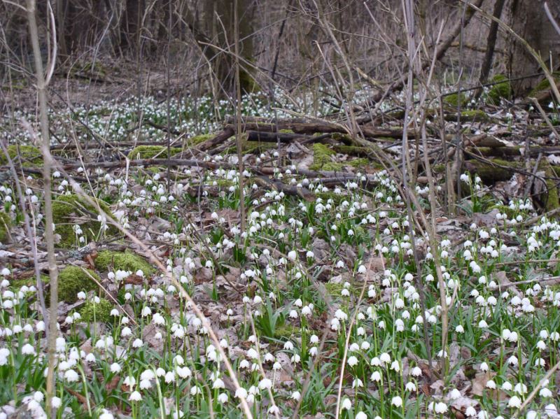
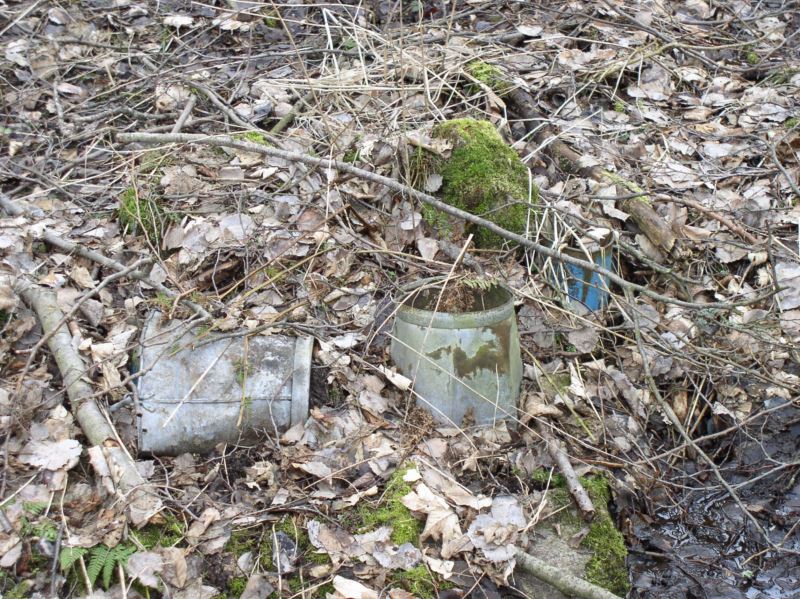
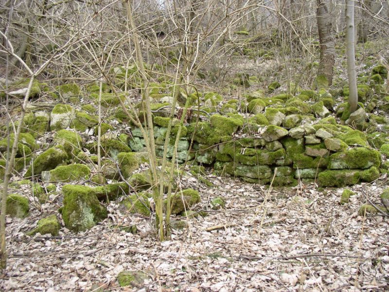
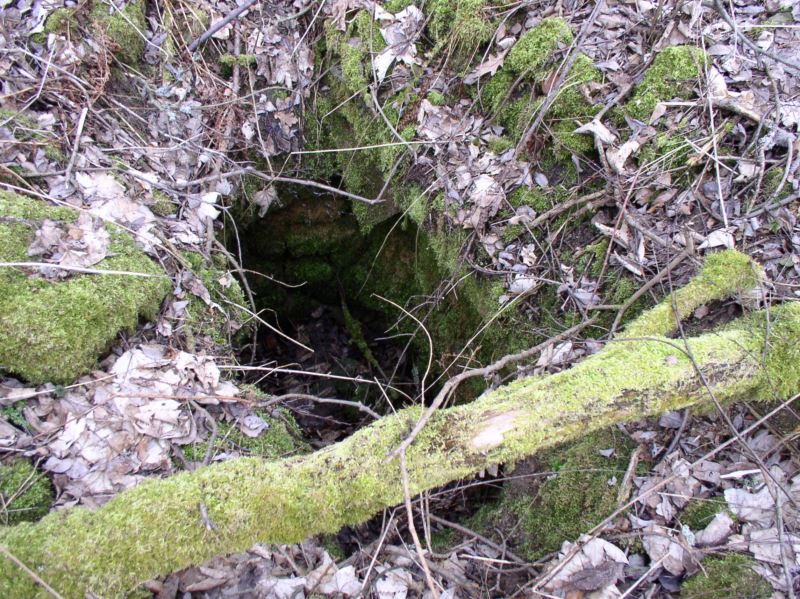
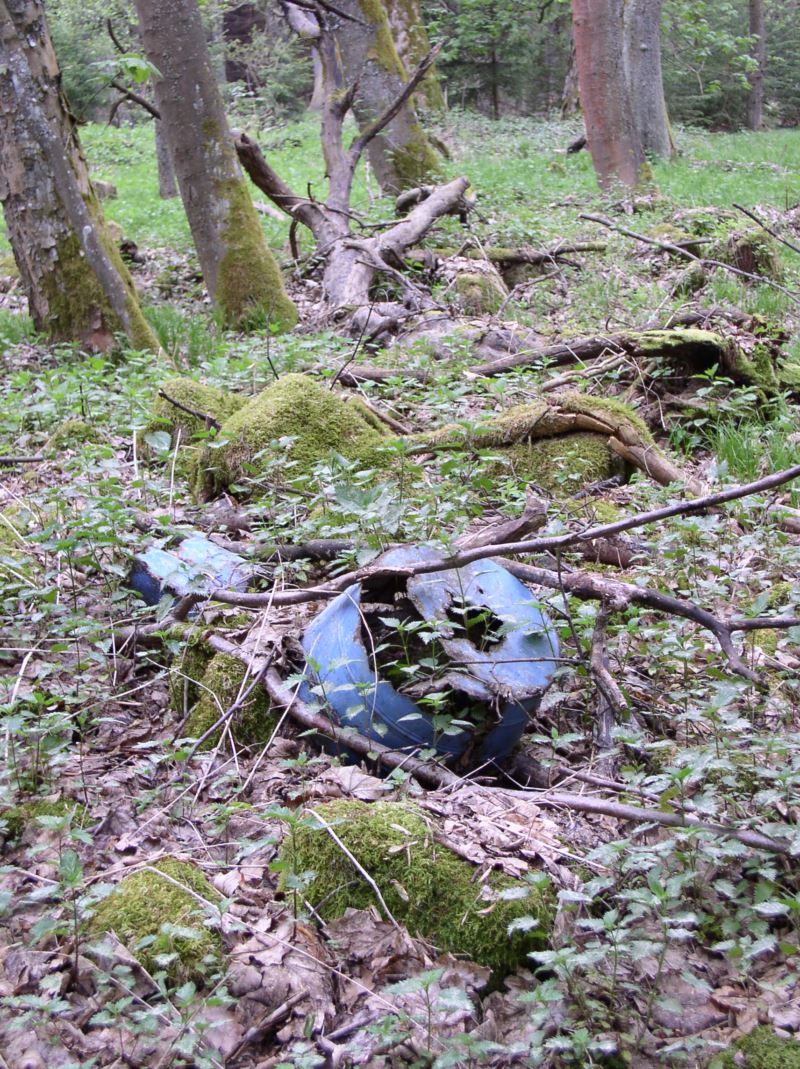
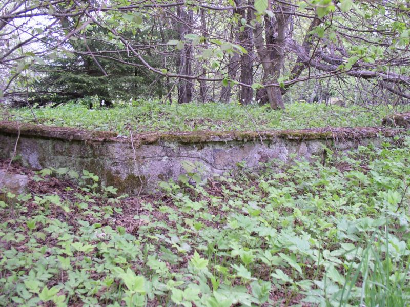
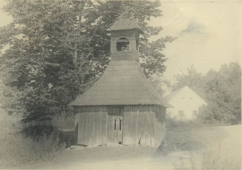
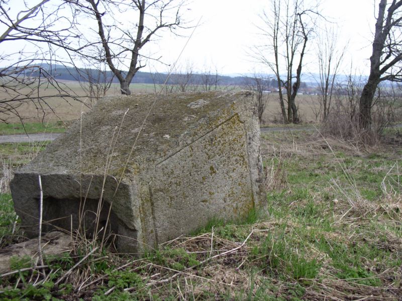
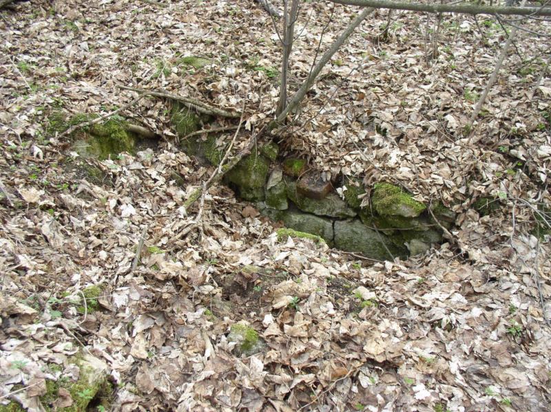
Within the territory of the Czech Republic exist hundreds of abandoned settlements. Life returned to some of those villages, but other places were left forever. Why did those settlements disappear? First example –Black Death As the population increased, people were forced to move to higher, cooler mountain areas where the fields were smallerand the soil less fertile, as i.e. in the Bohemian/Moravian Hills. Than the Black Death or other such diseases spread, the places emptied, and people moved back to lowlands with more fertile soil, often along the streams. Second example - Wars The wars of the past, especially the Thirty Years War, were merciless and devastating. The villages were burned down, the cattle scattered, the fruit trees damaged, and the wells filled in. In some areas nearly half of the population died. Small places disappeared without a trace; a church with a cemetery was all that remained of the larger villages. Third example–End of the castles The castles were usually surrounded by extensive settlements. Servants, soldiers and farmers used to live there. During the 16th century and later most of the castles perished and with them the settlements around the castles, which partly had reached the size of a small town. The population moved from the non-functional castle (mostly placed elevated on a hill) closer to the fields and the water sources. Fourth example–Exhaustion of the Resources Bohemia was rich in minerals such as iron ore and non-ferrous metals. Around the mines villages sprang up which after the exhaustion of the deposits disintegrated into solitary settlements. The miners usually had two main occupations. Next to the mines they ran small farms, forest, and grazing land. The miners often relocated to fresh mines, but some stayed in their old villages. The result of this was a transformation from a lively village to a few scattered houses. Similarly the glass huts moved to the forest as it was easier to move the production unit than the energy source. Fifth example–Failure of Development Projects Sometimes the nobility founded a new settlement inaunsuitable place, there was not enough water or spring frost destroyed the crop. These places struggled on for a while but yielded no profit so that the inhabitants moved on to more prosperous villages. Some places disappeared during the building of the ponds; others were destroyed later in modern times during the construction of dams or military training areas. Many villages were abandoned after World War II during the expulsion of those ethic groups deemed undesirable. Each place has its own story. For the archeologist it is important to know when(i.e. middle of the 15th century) the place disappeared (discovered relics date back to before that time)as based on the finds we are able to reconstruct the way of life. The history of a city we can find in the archives of written documents, but the history of small places can only be based on archeological finds. An important motivation for archeological research is also the fact that we know a lot about the life of the nobility, but nearly nothing about the way of life of the ordinary people, about the foundation of their dailylives such as local energy sources, ecological models, and nutrition. Political reasons for termination of villages after 1945 The expulsion of the Czechs from Sudeten are asoccurredin 1938 as a result of the Munich agreement. The main point of this agreement was the cession of the borderlands of Czechoslovakia to the German Empire within limits the Empire laid down.Approximately200,000Czechs, Czech Jews and German anti-fascists were forced to leave and this movement continued for several years thereafter. At the end of the Second World War the cards turned and there was massive deportation of the German population from the former Sudetenland (1945-1946). Many newly deserted villages in the border region were re-populated by Czechs, as part of the program “Building borderlands”. The villages that have found themselves behind the newly established border line called the “Iron curtain” (1948) were never re-populated again. The buildings were plundered and disassembled for material. What wasn´t destroyed by man, has been by time. The border zone was 4-10 km wide, and from 1952 to 1989 it was completely impassable. It gave the opportunity to nature for undisturbed development. In many places this isolated area has been turned into a preserved Green Belt system. Between 1945-1960 130 villages, 3000 settlements and 50,000 solitary houses vanished. |
|